Hi all
it seems that better weather is underway and that means that we can start planning new trips. One thing I always use to plan a trip to an airfield is my TomTom Sat-Nav system. To put the right photo spots in my Tom Tom, I use Google Earth. Google Earth has proved itself very useful to search for the best spots around airfields and with the output of this program you can then fill your sat-nav system again.
I have gathered a reasonable amount of photo spots in google earth/tom tom but I could use some help. Does anyone of want to share their spots so I can compile a large database and make it available online so we can all benefit ?
You can download my Google Earth file here and load it in Google Earth. Using http://www.poieditor.com/" onclick="window.open(this.href);return false; you can then convert this file to your TomTo, Garmin, Navman or many more systems
Download: http://franknoort.nl/airfields-europe.kml.zip
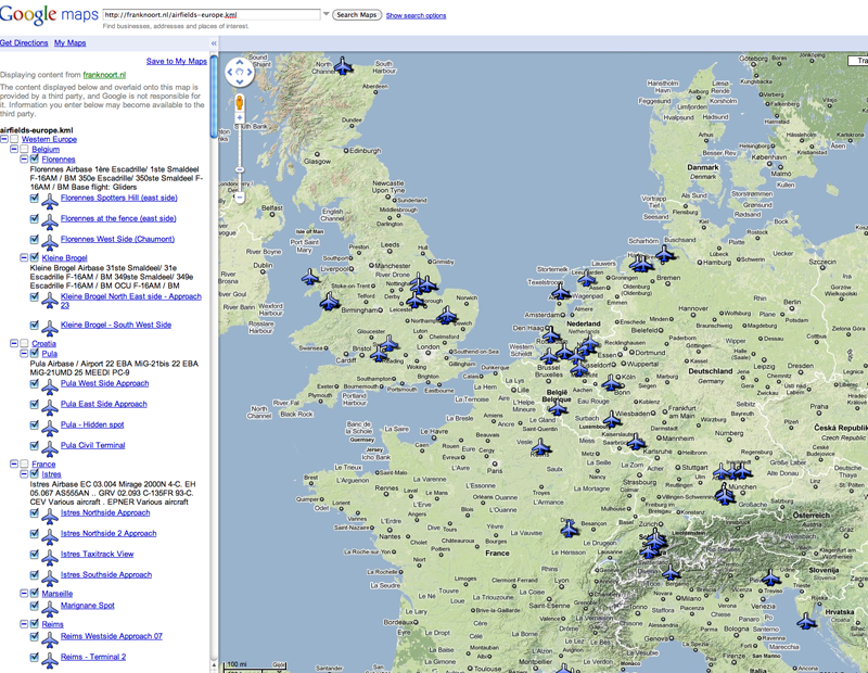
Here is how it looks like
http://maps.google.com/maps?q=http://fr ... europe.kml" onclick="window.open(this.href);return false;
Some previews:
Online (see also http://maps.google.com/maps?q=http://fr ... europe.kml" onclick="window.open(this.href);return false;)
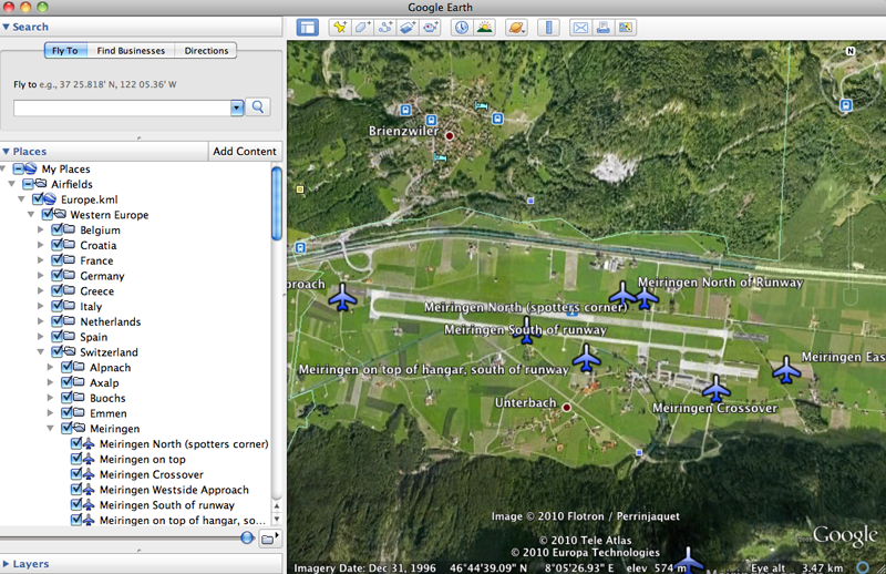
In Google Earth
Best photo spots in your satnav - Your input requested
Forum rules
- marcel32us
- Scramble Die-Hard
- Posts: 999
- Joined: 10 Feb 2005, 11:50
- Type of spotter: Alles wat vliegt, als er maar een motor aan zit.
- Subscriber Scramble: marcel32us
- Location: Nieuwegein
- Contact:
Re: Best photo spots in your satnav - Your input requested
Great Post!!! But didn't Iwan start a topic just like this one a few weeks ago??
- Spacedust
- Scramble Die-Hard
- Posts: 622
- Joined: 06 Jul 2003, 12:07
- Type of spotter: F5M
- Subscriber Scramble: Spacedust
- Location: 's-Hertogenbosch
- Contact:
Re: Best photo spots in your satnav - Your input requested
This topic as a starting point is a far more better league!
Re: Best photo spots in your satnav - Your input requested
Several topics have been opened on this same subject, but I think this is at least a real start, not just an idea. Personally I record a lot of info in GE (airfields, wrecks and relics, hotels, company locations abroad, etc etc) and I am very interested in sharing the spotting info. Not using Tom-tom or anything like that, but that doesn´t matter I think.
My biggest question though is if we can combine several subjects into one file. I know somebody on this forum already keeps track of helipads for example and I also downloaded once a file for ´planes on poles´. Both not exhaustive, but the larger the community, the more info you will gather.
Erwin
My biggest question though is if we can combine several subjects into one file. I know somebody on this forum already keeps track of helipads for example and I also downloaded once a file for ´planes on poles´. Both not exhaustive, but the larger the community, the more info you will gather.
Erwin
- Iwan Bogels
- Scramble Addict
- Posts: 2385
- Joined: 06 Sep 2002, 06:59
- Subscriber Scramble: Iwan Bogels
- Location: N 52°13"31.2 E 4°29"57.5
- Contact:
Re: Best photo spots in your satnav - Your input requested
Hi guys,
Yes, I did start a similar topic in 't Praethuys. But now that Frank is picking up on this, I will be happy to join his efforts. Below you will find my TomTom spots for Holland. These include stopts to useful photographic locations near our military airbases. Feel free to download them and use them in your own TomTom. I have even added a funny logo for the photospots.
The TomTom-file with the photo spots: http://www.dappa.nl/airbase-nl.ov2
The appropriate TomTom icon to go with it:
The GoogleEarth file with all spots, for if you want to merge them with your own spots: http://www.dappa.nl/airbase-nl.kml
I hope many people will join this project. If wanted I have my own file for Wittmund, as well as all airtanker bases in western USA.
Cheers,
Iwan
Re: Best photo spots in your satnav - Your input requested
I think this is what every aircraft spotter is looking for. But I do wonder: most NATO bases are excluded from Google Earth. How are we gonna deal with this?
Greetz,
Patrick
Patrick
- Iwan Bogels
- Scramble Addict
- Posts: 2385
- Joined: 06 Sep 2002, 06:59
- Subscriber Scramble: Iwan Bogels
- Location: N 52°13"31.2 E 4°29"57.5
- Contact:
Re: Best photo spots in your satnav - Your input requested
maps.bing.com
This shows all Dutch airbases in high detail. Maybe it's smart to save a digital copy of all airbases on disk, as these maps might also be blurred some day.....
Cheers,
Iwan
This shows all Dutch airbases in high detail. Maybe it's smart to save a digital copy of all airbases on disk, as these maps might also be blurred some day.....
Cheers,
Iwan
Re: Best photo spots in your satnav - Your input requested
Most of the time the internal area of the base are somehow scrambled, not the part outside the fence. So you can still easily show the spots itself. And even if not, if you know the coordinates you can place a pin there and when you are driving (and the place is accessible) it is also no problem.SquAdmin wrote:I think this is what every aircraft spotter is looking for. But I do wonder: most NATO bases are excluded from Google Earth. How are we gonna deal with this?
Erwin